Plant Trees in Ditmas Park West, Sunday, 4/26

I helped plant this Zelkova serrata, Japanese Zelkova, last year.
Tamping in

Part of the Arbor Day weekend activities in Flatbush, on Sunday you can help plant 9 trees in Ditmas Park West, one of the neighborhoods of Victorian Flatbush.

Meet at 10am at 458 Rugby Road [GMAP]. Bring your own tools and gloves, if you have them. Wear sturdy work boots, and prepare to get dirty! No rain is predicated through the weekend, so you won’t have to deal with last year’s mud. Possibly record highs – temperatures in the upper 80s – are predicted for Sunday, so wear your sunscreen and bring lots of water to stay hydrated.

At the meeting place, they will form work crews which will fan out to different locations. Some will plant trees, some will do cleanups. At 1pm, folks meet up for lunch.

[bit.ly] [TinyURL]

Related Content

2008 Ditmas Park West Tree Planting

A recent history of Cortelyou Road

Cortelyou Road, North side, looking East from Westminster Road, September 2006, before the new streetscape was put in place in Spring of 2007.
Cortelyou Road, South side, looking East from Westminster Road

Neighbor, friend, and local real estate agent Jan Rosenberg writes of changes in our neighborhood in the online journal NewGeography:

Twenty some years ago my husband, 2 young sons and I moved from our cramped 16-foot wide attached row house in Brooklyn’s trendy Park Slope to a free-standing, 7-bedroom Victorian house in the Ditmas Park section of Flatbush with stained glass windows, pocket doors, original wood paneling, a back yard, front porch, driveway and 2-car garage in a little-known, tree-lined neighborhood about 10 minutes away – on the other, high-crime side of Prospect Park.
Gentrification from the inside out in Brooklyn’s Ditmas Park

I know everyone’s tired of hearing it from me, but this is not Ditmas Park. It’s Beverley Square West and Ditmas Park West. Or Victorian Flatbush. Or just plain Flatbush. I suspect the editors provided the title, not Jan.

We’re newcomers to the neighborhood. We’ve only been here since the Spring of 2005. Most of our neighbors have been here much longer than that, even longer than Jan’s “twenty some” years. Jan summarizes what we hear from the “old-timers:” not so long ago, moving to this neighborhood was a pioneering act:

When crime exploded in the 1960s and welfare tenants were moved into some of the apartments, much of the middle class – white and black – fled. By the early 1990s many assumed that nothing could be done about the collapse of the quality of life. It wasn’t unusual for police officers in that era, many of whom lived in suburban Suffolk County, to respond to crime victims condescendingly by asking, “What do you expect if you live in a neighborhood like this?”

Little changed even after the extraordinary Giuliani/Bratton efforts brought down crime, little changed in the mid-1990s. The district’s once thriving shopping street, Cortelyou Road , still had no bank, no coffee shop, no diner, no sit-down restaurant, no children’s store, no real estate office.

The “from the inside out” part describes the efforts by Jan and other long-time residents to build community through a variety of means. Jan focussed her efforts on the 7 blocks of Cortelyou Road, from Coney Island Avenue to East 17th Street, that are zoned to allow commercial use. She credits other neighbors, as well, with transforming Cortelyou Road into our Main Street:

One incredible woman, Susan Siegel, decided she wanted to bring a farmers market to the neighborhood. She worked on this full time, and a year later it opened! Some Cortelyou grocers objected to having it on their strip; a few vocal homeowners objected to unlocking a public school yard and using it to house the market. Ironically the fight over the market swelled into a local “pro-development” movement, made up of people alive to the new possibilities, and sparked a neighborhood newsletter.

Once it opened in 2002, the Farmers Market became an informal community center, a literal common ground, for our neighborhood. The Market became a place where the full range of neighborhood residents could come together to buy fresh fruits and vegetables and to catch up on what’s happening in the schools, the playgrounds, and stores including a highly successful organic food co-op. Until then, only the homeowners were organized but now new co-op owners, home owners, and renters all came, mingling freely with each other, and with “veterans”, in a way that had not previously been the case.

Red Jacket Orchards, Greenmarket, Cortelyou Road, July 2007
Red Jacket Orchards, Greenmarket, Cortelyou Road

Although Jan doesn’t mention it in her article, the transformation of the Cortelyou Road streetscape resulted from many years of organizing and planning from several different sources, including the Flatbush Development Corporation (FDC). FDC has been active since arson for insurance fraud was a serious concern for the neighborhood, unthinkable today, when the same homes that might have been torched 20 years ago are going for over $1 million. FDC sponsors the annual Flatbush Frolic, which takes place on Cortelyou Road, and has been running for 31 years.

Cobblestones, Cortelyou Road, South side, West of Stratford Road, march 2007. That’s Coney Island Avenue in the background.
Dry-laid cobblestones, Cortelyou Road, South side, West of Stratford Road

The new clock at night, in April 2008, shortly after it was installed this Spring, on the grounds of P.S. 139 at the corner of Rugby Road.
Cortelyou Clock at Night

Even before we moved into the neighborhood, James Heaton’s Flatbush Residents Email Network Database – FREND – served as an introduction to the cultural landscape and issues of the neighborhood we were adopting.

Jim Heaton, a local advertising executive initiated an online newsletter, FREND, [which] served to “connect” nearly a thousand people and families to the new initiatives, particularly around the Farmers Market and crime …

The successor to FREND is The Flatbush Family Network, started by two other neighbors:

The on-line contribution really blossomed in 2003 when Ellen Moncure and Joe Wong revived the Flatbush Family Network (FFN) . This site has become an invaluable source of neighborhood and childrearing information for the many young families who live here. For many people moving into this neighborhood, FFN provides an initial introduction and orientation to life in this neighborhood. For those who live here, it’s a convenient, ongoing source of information and support.

Related Content

Cortelyou Road Park, Park(ing) Day NYC 2008, September 2008
The Daffodil Project is in bloom on Cortelyou Road, April 2008
Cortelyou Road (Flickr Collection)

Links

Gentrification from the inside out in Brooklyn’s Ditmas Park, NewGeography
Changing Ditmas Park, Ditmas Park Blog
Race, Class and Gentrification in Ditmas Park, Brownstoner

New Flatbush Rezoning Proposal Gets It Right

Update, 2009-07-29: Flatbush Rezoning Proposal approved by City Council


477 Westminster Road, Ditmas Park West, one of hundreds of homes that will receive more protection with DCP’s revised draft
447 Westminster Road, Ditmas Park West

NYC’s Department of City Planning (DCP) provided the first view of their revised draft of the Flatbush Rezoning Proposal to Brooklyn’s Community Board 14 (CB14) on September 3, and more recently to the CB14 Executive Committee on September 18. I wasn’t able to sit in on any of the meetings, but I’ve spoken with folks who’ve seen the new proposal first hand.

The revised draft is covered in Flatbush Life, including a photo of the redrafted map:

After a presentation to the executive committee of Community Board 14 – which greeted the plan warmly – the Department of City Planning (DCP) is moving forward to certify the proposal, which will launch the formal approval process for the rezoning.

During the meeting, which was held in the board office, 810 East 16th Street, DCP received accolades from board members and area residents for reworking the plan to take into account neighborhood concerns.

Flatbush rezoning moving forward

I wrote a detailed report about the earlier draft that DCP presented to CB14 and at a public hearing back in June. From everything I’ve heard and seen about this second draft, they got it right. In general, lots that are 50×100 feet will get the R3X designation, while lots that are 40×100 will get R4A. This is a more tailored approach than the broad brush of R4A that was painted over Ditmas Park West and South Midwood in the first draft. (See my original post for complete details on these zoning designations.)

They really listened to the concerns of residents, went back and re-drafted to address them. The free-standing homes responsible for the physical character of this area of Flatbush will be protected. All of Flatbush will be protected against unlimited height residential development. There are new opportunities for commercial development, and incentives for affordable housing. It’s hard to find something to critique in this draft.

Related Posts

Flatbush Rezoning Proposal will define the future of Victorian Flatbush, 2008-06-13

Links

Flatbush rezoning moving forward, Flatbush Life, 2008-09-28
Rezonings for Flatbush, Canarsie Move Forward, Campaign for Community-Based Planning, 2008-10-06
Flatbush Rezoning Moving Forward, Ditmas Park Blog, 2008-10-07

Flatbush Rezoning Proposal will define the future of Victorian Flatbush

Update, 2009-07-29: Flatbush Rezoning Proposal approved by City Council
Update, 2009-03-02: DCP certified the proposal.


David Parish, DCP, describing the proposed rezoning for South Midwood
David Parish describing the proposed rezoning for South Midwood

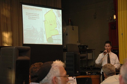
Last night I attended Brooklyn Community Board 14’s (CB14) preliminary public hearing on the NYC Department of City Planning’s (DCP) rezoning proposal for the northern half of CB14, ie: Flatbush. I didn’t take a head count, but roughly 100 people turned out to attend the hearing in Public School 249’s uncooled auditorium. CB14 chair Alvin Berk informally explained the context and ground rules for the meeting, then officially called the hearing to order at 7:23. After the school guard kicked us out – gently, but firmly – after 9:30pm, conversations continued onto the school plaza and sidewalks. I didn’t get home until well after 10pm last night.


Some highlights:

  • One of the four major goals of the proposal is to preserve the existing free-standing single- and two-family homes that characterize the area. On this point, support seemed unanimous, although the terms detached, semi-detached, and attached were new to some in the room and is the cause of some confusion.
  • Not only Ditmas Park West, but South Midwood would be rezoned to R4A. This was the most troublesome part of the proposal at last night’s hearing; nearly all who spoke during the public comments section of the meeting (including me) opposed this particular zoning designation, for reasons explained below.
  • While current zoning puts many of these homes and streets at risk from development, the proposed rezoning may endanger even more.
  • Zoning is a blunt instrument. Currently available zoning designations are insufficient, or at least too coarse, to reflect and respect the existing housing stock in these neighborhoods.

My report will necessarily be incomplete. This was the first time I’ve ever attended a public hearing, so I had only a general idea of what to expect. I had not seen the details of the proposal prior to the meeting. My main purpose in attending the meeting was to learn more details. Unfortunately, there was no opportunity to study the large, detailed exhibits that DCP brought with them. There was only the presentation, and I was writing furiously to try to capture details as they were presented. I also had an opportunity to speak during the public comments section of the meeting. After I spoke, I was out of the room for a few minutes while I (unsuccessfully) sought water. I missed a few speakers during my absence.

The study area

The study area encompasses nearly all of the northern half of CB14. Here’s a detailed map of the study area provided by DCP.

Boundaries of the Study Area
DCP Flatbush Neighborhood Rezoning Study Area

This map of the existing zoning districts was also provided by DCP. To view the map more clearly, follow the link from the map to its Flickr page (just click the image), then select All Sizes > Original.

Existing Zoning
DCP Flatbush Neighborhood Rezoning Existing Zoning

Nearly all of the study area is zoned for residential use. The few commercial-only districts are at the edges. The C4-3 district at the southeast corner of the area is Brooklyn Junction, the intersection of Flatbush and Nostrand Avenues. The largest commercial area is the C4-2 district on the eastern boundary of the study area. This is bounded roughly by Flatbush and Bedford Avenues on the west and east, and Church Avenue and Cortelyou Road on the north and south. Important commercial/retail landmarks in this district include Sears and the Kings Theater.

Loew’s Kings Theater, Flatbush Avenue, just north of Beverly Road
Loew's Kings Theater, Flatbush Avenue

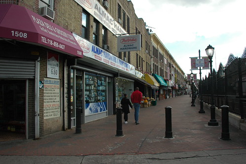
Most of the commercial space is provided as commercial overlays, shown with hatch marks on the map. You can see these along Nostrand and Flatbush Avenues, Church Avenue, Coney Island Avenue, Cortelyou Road, and Newkirk and Foster Avenues. The overlay that spans Newkirk and Foster Avenues at the Newkirk Avenue subway station is Newkirk Plaza.

589-597 Coney Island Avenue
589 (left), 591, 593, 595 and 597 Coney Island Avenue

Cortelyou Road, south side, looking west from Westminster Road

Newkirk Plaza, looking south from Newkirk Avenue toward Foster Avenue. The subway cut is on the right of the photo.
Newkirk Plaza

Within the study area, there’s a wide range of density in residential districts, from R1-2 to R7-1. R1 through R5 are lower-density districts. R6 and R7 are medium-density. There’s also a wide range of housing types.

There are three landmarked historic districts typified by free-standing homes. You can easily locate these on the map by the R1-2 districts. From north to south, they are Prospect Park South, Ditmas Park, and the recently approved Fiske Terrace-Midwood Park. Midwood Park is the southernmost R1-2 area, and Fiske Terrace is the R2 area just south of that. Both R1-2 and R2 allow only single-family detached houses.

Our detached houses are not limited to the landmarked areas. The majority are not landmarked, occupying residential zones ranging from R2 to R6. Those in R6 zones – including those in my neighborhood of Beverley Square West – are at greatest risk.

Summary of the Proposal

The proposal is still only a draft, so all the specifics are still subject to change before the formal proposal, which kicks off the ULURP process. There are four major goals for the rezoning:

  1. Preserve the existing free-standing (detached) single- and two-family houses.
  2. Match new zoning to existing buildings as closely as possible without “under zoning”.
  3. Encourage creation of affordable housing through incentives.
  4. Create opportunities for commercial growth.

In rezoning projects, one of the things DCP looks at is “non-compliance”: does existing development on a site comply with what’s allowed by its zoning designation? Non-compliant and under-zoned describe the same situation: the former applies to the house, the latter to the zoning of the property. Non-compliant does not necessarily mean illegal. The conditions may have pre-dated the zoning; in a neighborhood of homes over 100 years old, they likely do. To understand non-compliance, we need to know the current zoning designation and what it permits.

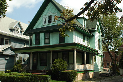
Case Study: Beverley Square West

Beverley Square West is bounded by Beverly and Cortelyou Roads on the north and south, and the B/Q subway cut and Coney Island Avenue on the east and west. The homes here are detached, single- and two-family homes with peaked roofs, most of which were built in the late 1890s and early 1900s. Most of the lots are 50 feet wide by 100 feet deep.

308 Stratford Road, Beverley Square West
308 Stratford Road

This map shows the outlines of buildings on all properties in the area. The detached homes stand in contrast to row houses along the southern side of Cortelyou Road and the eastern side of Coney Island Avenue.

Single- and Two-Family Homes and existing Structures, Beverley Square West

Most of the area is zoned R3-2, with R6 zoned along the western and southern boundaries.

Existing Zoning, Beverley Square West

Neither R3-2 nor R6 match the existing character of the neighborhood. R3-2 allows not only detached homes but semi-detached homes – side-by-side – as well as fully attached homes, ie: rowhouses. R3-2 specifies a minimum lot width of 40 feet for detached houses, but only 18 feet for semi-detached or attached.

The base floor-to-area ratio (FAR) for R3-2 is .5, or 50%. A typical lot is 50′ wide by 100′ deep, for a total lot area of 5,000 square feet. 50% of that is 2,500 square feet, the maximum permitted floor area for a building with a flat roof. R3-2 also carries an attic allowance, which encourages preservation and development of homes with peaked roofs, of .1, for a total FAR of .6. Since the typical lot area here is 5,000 square feet, 50 x 100, and 60% of that is 3,000 square feet, a house with 3,000 square feet or less is compliant with the .6 FAR. Our house, for example, is 2,750 square feet, as it’s been since it was converted from a single-family to a two-family home in the 1930s, during the Great Depression of that era.

R6 is a medium-density designation and allows for much denser development, typified by this new condo building recently completed at the corner of Stratford and Cortelyou Roads.

1103 Cortelyou Road

The R6 districts are at greatest risk from being torn down for new development. In Ditmas Park West, several homes have already been lost to teardown. To achieve the first goal of the rezoning project, preservation of the existing detached homes, the new zoning must allow only detached houses. Zones which permit only such housing are R3A, R3-X, R4A, and R5A. To preserve the scale of the neighborhoods, the new zoning must come close to the existing FAR of the homes already built. Both R3A and R3-X share the .6 FAR of R3-2. R3-X has the larger minimum lot width, at 35 feet. Of currently available zoning designations, R3-X comes closest to what’s already in place in Beverley Square West. In fact, the current draft of DCP’s zoning study proposes R3-X for both Beverley Square West and East.

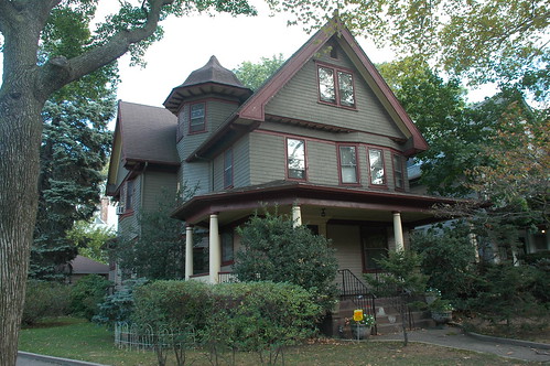
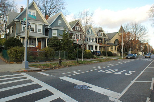
Case Study: South Midwood

A house in South Midwood
House in South Midwood

Many of those attending the meeting seemed to be from South Midwood, one of the many neighborhoods that comprise the “Victorian Flatbush” part of Flatbush. The current and proposed zoning for this neighborhood provides a good case study for what’s at stake: the risks to the area from current, inappropriate zoning; the strategies DCP employs when trying to select new zoning most likely to be approved; and the issues with the new designation DCP selected. Also, it’s the only section of the presentation for which I got some usable photographs.

This neighborhood was developed at the turn of the 20th Century, before zoning existed. When the current zoning was established in 1961 (more or less), over 45 years ago, there was little consideration for what was already in place, and whether or not the new zones fit the existing context.

Ditmas Park West and South Midwood, the areas to be rezoned R4A, have a mix of zoning, the majority of which is R3-2. As explained above, R3-2 allows a FAR of .6: .5 base, plus an attic allowance of .1. R4A allows a .9 FAR: .75 base, plus a .15 attic allowance. The R4A FAR of .9 is an increase of 50% over what’s permitted today. It’s this large increase in FAR that raises concerns for residents in these two neighborhoods, who are concerned it will open the door for expansion and enlargement of existing homes, or new development, out-of-scale with the existing homes.

South Midwood, Current Zoning

South Midwood, Proposed Zoning
South Midwood, proposed rezoning

Another house in South Midwood
A house in South Midwood

DCP’s rationale for proposing R4A over R3-X comes back to the issue of under-zoning. They look at the existing buildings to see whether or not they are compliant with the current zoning. When rezoning, they try to assign a new designation in which 75-80% of existing structures would be compliant. This numeric goal arises from practical and political considerations: they want to minimize objections to the rezoning proposal from property owners concerned that their options for expanding or enlarging their homes are being restricted.

However, the situation here is different. By DCP’s calculations, only 51% of existing homes in South Midwood are compliant with the FAR of their current zoning, mostly .6 FAR in the R3-2 district. But the homeowners here are not complaining about lack of expansion options. They are concerned for the future character of their neighborhood caused by an increase in FAR of 50%.

This is one reason why I referred to zoning as a “blunt instrument” at the beginning. There’s no zoning designation which permits only detached houses with a FAR between .6 and .9. To reach their goal of 75-80% compliance – a threshold determined by political efficacy, not a legal mandate – DCP has to leap to the next available FAR of .9 in R4A. But this leap has generated opposition which the threshold was intended to avoid. An intermediate total FAR, of .75 say, which would be an increase of only 25% instead of 50%, would be a better fit and would not receive the same level of opposition. Barring creation of a new zoning designation, residents speaking at Thursday’s meeting called for a new designation of R3X, maintaining the status quo, instead of R4A, which would open up the neighborhood to out-of-scale development.

Related Posts

Flatbush Rezoning Proposal, May 23, 2008
Preserving Livable Streets: DCP’s Yards Text Amendment, November 7, 2007
Victorian Flatbush at risk from inappropriate zoning, October 23, 2007
State of Flatbush/Midwood, October 5, 2007
Landscape and Politics in Brooklyn’s City Council District 40, February 14
NASA Earth Observatory Maps NYC’s Heat Island, Block by Block, August 1, 2006

Important DCP Links

Residence District Zoning Explained
Table comparing R1 through R3 (PDF)
Table comparing R4 through R5 (PDF)
DCP Zoning Glossary

Other Links

South Midwood Residents Association
Brooklyn Community District 14 Profile (PDF)

Ditmas Park West Tree Planting

Updated 2008.04.29: Added link to Anne Pope’s Sustainable Flatbush post and Flickr photo set.


Placing the tree

This morning I helped, for the first time, to plant a street tree. It had rained overnight and was still raining when we started. Just one word to sum it all up:

MUD

Ditmas Park West is one of the neighborhoods of Victorian Flatbush. It’s bounded by Cortelyou Road and Newkirk Avenue to the north and south, and Coney Island Avenue and the B/Q subway cut to the west and east. Over 25 years, Ditmas Park West has planted over 300 trees, averaging more than 10 trees each year.

About 25 people showed up this morning and fanned out to different locations. 6 or 7 trees got planted today. The crew of 10 or so I went with had two jobs: clear trash from a vacant lot and dig out a tree pit for a new tree to be planted.

The realities of urban street planting are not so idyllic as our vision of leafy green streets. First, we had to break through a few inches of concrete dumped over asphalt. Bob was handy with the ax.

Breaking up concrete and asphalt

Beneath all that, we had some not so bad, if compacted, clay.

Breaking up the clay

Once the tree was delivered we measured the depth of our dig and compared it to the height of the root ball.

Measuring depth

And kept digging until we got to the right level.

Still not deep enough

Then we rolled the tree into place …

Rolling the tree in Rolling the tree in Placing the tree

… filled in around the base, leveled, and stabilized the tree …

Tamping in

… and began filling in and tamping down.

More dirt!

Once the tree was stable, we cut off the twine and removed burlap from the top of the ball. Roots got pulled out and spread out as we went along.

Cutting twine and burlap
Removing some burlap

Meanwhile, in the adjacent vacant lot, our comrades had done an incredible job clearing trash and rubbish.

Rubbish

I look forward to future greening opportunities. I need some good work boots for next time.

Related Posts

Flickr photo set
Plant Trees in Ditmas Park West

Links

Ditmas Park West Tree Planting, Sustainable Flatbush
Many more photos from Anne Pope of Sustainable Flatbush

[where: 400 Stratford Road, Brooklyn, NY 11218]

Sunday, April 27: A day for trees in Flatbush

A reminder that you have two opportunities to get your green on in Victorian Flatbush this Arbor Day weekend on Sunday, April 27.

Ditmas Park West Arbor Day 2008Flyer for Sustainable Flatbush Street Tree Walking Tour

At 9:30am, meet at 458 Rugby Road to plant trees in Ditmas Park West and spruce up tree pits. Over 14 years, Ditmas Park West residents have planted 300 trees. Their long-running tree-planting program can serve as a model for other neighborhoods to green their streets.

Starting at 1pm, meet at 1414 Cortelyou Road to enjoy and learn about some of the trees in Victorian Flatbush. The Sustainable Flatbush Street Tree Walking Tour will loop through the neighborhoods of Beverley Square West and Prospect Park South. A Google Map of the tour route is available.

Related Posts

Plant Trees in Ditmas Park West
Sustainable Flatbush Street Tree Walking Tour

Links

Sustainable Flatbush
Trees New York

Sunday, April 27: Plant Trees in Ditmas Park West

North side of Dorchester Road between Rugby and Marlborough Roads, Ditmas Park West

On Sunday, April 27, Arbor Day weekend, join the residents of the Victorian Flatbush neighborhood of Ditmas Park West to:

  • Plant Trees
  • Liberate Tree Pits
  • Beautify the Neighborhood

This is Ditmas Park West’s 14th Annual Arbor Day weekend tree planting. It is well-organized and coordinated with City resources such as Parks. Even if you don’t live in Ditmas Park West, this event can provide you with ideas for organizing and mobilizing your neighbors to clean up your streets, become stewards of street trees, and build community in the process.

Arbor Day 2008

To participate, meet at 458 Rugby Road at 9:30am to join a crew. Heavy excavation will be done with power equipment. You can bring your own gardening tools, as well. Work continues for about two hours, then everyone gets a chance to share a light lunch.

Southeast corner of Dorchester Road and Rugby Road, Ditmas Park West

Related Posts

Wanna Fight Crime? Plant Trees, February 1, 2008

The Daffodil Project is in bloom on Cortelyou Road

Cortelyou Daffodil
Cortelyou Daffodils

This evening I came home via the Cortelyou Road stop on the Q train. I wanted to stop by John’s Bakery to pick up some munchies. I had to cross the street: the Daffodils are just starting to bloom.

They’ve started on the north side of the street, as I expected. The south side has been shaded by the stores and apartment buildings until recently. The soil in the tree pits there has not been warmed by the sun which the north, unshaded side of the street has been getting.

Cortelyou Daffodils

Last fall, two dozen volunteers planted 1,000 Daffodil bulbs and 400 Crocus corms over two weekends. The Crocus are all but spent now; just a few raggedy blooms hanging on here and there. The Daffodils are just getting started.

Cortelyou Daffodils

As in past years, there’s no way to know what you’re going to get when you plant the bulbs in the Fall. I saw at least four different kinds in bloom today.

Cortelyou Daffodils

It seems a far remove from 9/11, the inspiration for the Daffodil Project. But it was very much in the consciousness of at least some of us who planted these bulbs. And certainly in the minds and hearts of my neighbors who took the initiative to request these bulbs to be planted in their neighborhood.

Related Posts

My Flickr photo set of this project
Cortelyou Crocuses!, March 6, 2008
Cortelyou Road Crocus Watch, February 4, 2008
Tree Pits are not Dumpsters, November 18, 2007
The Daffodil Project Plantings on Cortelyou Road, November 4, 2007
1,000 Daffodils for Cortelyou Road, October 27, 2007
The Daffodil Project: Grief & Gardening #5, November 26, 2006

Links

The Daffodil Project

Times admits past errors: We are not all Ditmas Park

A House in Caton Park
House in Caton Park

I am astonished to find that tomorrow’s New York Times City Section has an article on Victorian Flatbush, not “Ditmas Park,” which they finally realize only applies to one historic district in this large area. And in this article, they focus on the “forgotten” neighborhoods, those which don’t have landmark protection, and which are in danger of being eroded and lost forever to “development”:

The neighborhoods of Victorian Flatbush are of particular interest to historians because in many respects they were the first suburbs. With the newly built Brooklyn Rapid Transit rail line stretching out to Coney Island, the farmland of the Dutch village of Flatbush became a prime location in the early 20th century for what was considered commuter living.
Peaked Roofs, Crossed Fingers

315 East 18th Street, Beverly Square East

All the neighborhoods featured houses built in the most fashionable of Victorian-era styles, among them Tudor, Queen Anne, Colonial Revival and Georgian. These houses, adorned with carved moldings, fluted columns, copper trimmings and wide, open porches, evoked a lifestyle that went beyond architecture. Exclusive social clubs flourished in the area, as did community associations, many of which have been the driving force in campaigns for historic protection.

457 Rugby Road, Ditmas Park West
457 Rugby Road

House in South Midwood

“We don’t want the Manhattanization of Brooklyn,” said Ron Schweiger, the Brooklyn borough historian and a longtime resident of Beverley Square West. “We don’t want high-rises coming into residential areas. That’s why we want all of Victorian Flatbush to get historic district status.”

And though the neighborhoods of Victorian Flatbush have distinct characters, nearly all of them have one thing in common: residents eager to protect what is a remarkable and in some cases irreplaceable architectural history.

Beverley Square West

341 Rugby Road, Beverley Square West

209 (Left) & 215 (Right) Stratford Road, Beverley Square West
209 (Left) & 215 (Right) Stratford Road

There’s a little bit of hand-waving around my neighborhood of Beverley Square West, resulting in several inaccuracies.

Beverley Square East and West, nestled between Prospect Park South and Ditmas Park [and Ditmas Park West] and completed just after the turn of the 20th century, were Ackerson’s major projects. The developer also got certain streets that run through Beverley Square West rechristened with upper-crust British names: East 12th, 13th, 14th and 15th Streets became Westminster, Argyle, Rugby and Marlborough Roads.

Somehow the Times lost one-fifth of Beverley Square West, omitting Stratford Road (East 11th Street) from their description of the neighborhood. Stratford Road is both the westernmost block and the one most at risk from inappropriate zoning in Beverley Square West and Ditmas Park West.

The street names originated in the development of Prospect Park South by Dean Alvord. Ackerson’s early advertising for developments here still used the numbered designations of East 11th, 12th, and so forth, not the names. By 1902, the named designations were extended south to what would become Beverley Square West and Ditmas Park West. Our bill from Con Ed, which was around before this building boom of the early 1900s, still uses the numbered designation for our street address.

All the original homes of the Beverley Squares were individually designed. Ackerson himself lived in a house in Beverley Square West, and the developer Pounds, a future borough president, lived in Beverley Square East.

From what I’ve learned of the history of the development here, this is not accurate. The houses on Stratford and Westminster Roads are stylistically different from those on Argyle, Rugby and Marlborough. Although no two houses are exactly alike on Stratford and Westminster, neither do they feature much of the architectural details – turrets, round oeil de boeuf (ox-eye) windows, unusual dormers, and so on – visible on nearly every house on the other blocks.

I think the houses on these two westernmost blocks were built largely using Victorian pattern books widely available at the time; they were mostly “builders’ specials,” not designed by architects. They were built earlier, and not by Ackerson. Early Ackerson promotional photos show houses already standing on Stratford and Westminster while Argyle and Rugby are nothing more than empty lots.

The earliest neighborhood name I’ve found for these five blocks is Matthews Park. Matthews Court is one of the short side streets joining Stratford Road and Coney Island Avenue. Not that long ago, “Beverley Square West” referred only to the Ackerson-developed blocks of Argyle, Rugby and Marlborough Roads. Stratford and Westminster had their own neighborhood association, called Westford Park. These two neighborhood associations joined forces to form the current, five-block Beverley Square West Association.

Street Sign, Matthews Court

Related Posts

Victorian Flatbush at risk from inappropriate zoning, October 23, 2007
Landscape and Politics in Brooklyn’s City Council District 40, February 14, 2007
Matthews Park, September 29, 2006

Links

NoProPaSo, Kneel Before Your Creator, Crazy Stable
Victorian Flatbush: An Architectural History (Warning: contains intrusive popups)

Cortelyou Crocuses!

This morning I took a slight detour from my commute routine to check the tree pits along Cortelyou Road for blooming Crocuses. I was rewarded:

Cortelyou Crocus

It may not look like much, but this is only one of the 400 Crocuses neighborhood volunteers planted last fall in some of the tree pits along Cortelyou Road between Coney Island Avenue and East 17th Street.

It also has a companion blooming in the same tree pit:

Cortelyou Crocus

Until the rest of them start blooming, if you’re not looking for them, you’ll probably overlook them. Here’s how they appear in situ as you walk by the tree pit:

Crocus blooming in a treepit on Cortelyou Road, Brooklyn

The Crocuses have been up for a month; these are the first blooms. The Daffodils are also emerging in several of the tree pits.

Someone’s (or someones’) been doing a good job keeping the tree pit fairly clear of garbage. Nevertheless, you can identify several fragments of urban street detritus, including chewing gum, bits of plastic straw, and um, organic material.

This morning I didn’t see any bags of garbage in the tree pits themselves. When I see this, I try to stop and lift the bags out to place them on the outside of the protective fences. But for the past few days I’ve also seen a bike locked to the inside of the fence, right where the bulbs are coming up. I want to make up some signs to put along all the tree pits to remind folks:

LIVE PLANTS
NO TRASH
NO BIKES
NO DOGS

The bike locked up so it’s crushing the emerging bulbs deserves its own sign.

Over the next two weeks we should see a succession of different Crocus blooming. These yellow ones look like Crocus chrysanthus or something similar. Other may be purple, blue, or even white. I purchased “mixed” Crocus for this planting, so that’s what we should expect!

Related Posts

Cortelyou Road Crocus Watch, February 4
Tree Pits are not Dumpsters, November 18, 2007
The Daffodil Project Plantings on Cortelyou Road, November 4, 2007
1,000 Daffodils for Cortelyou Road, October 27, 2007
The Daffodil Project: Grief & Gardening #5, November 26, 2006

Links

The Daffodil Project